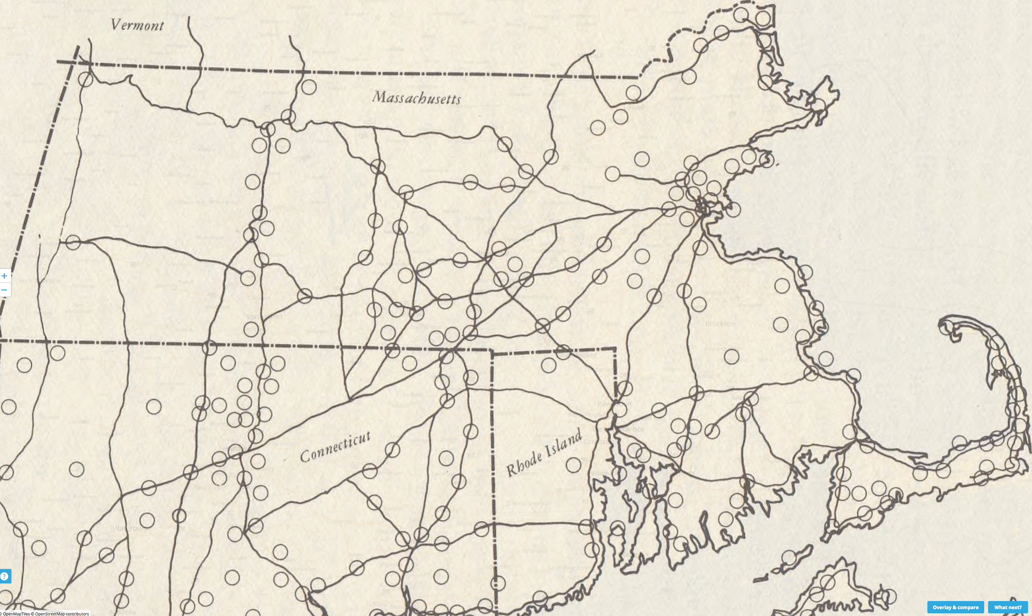
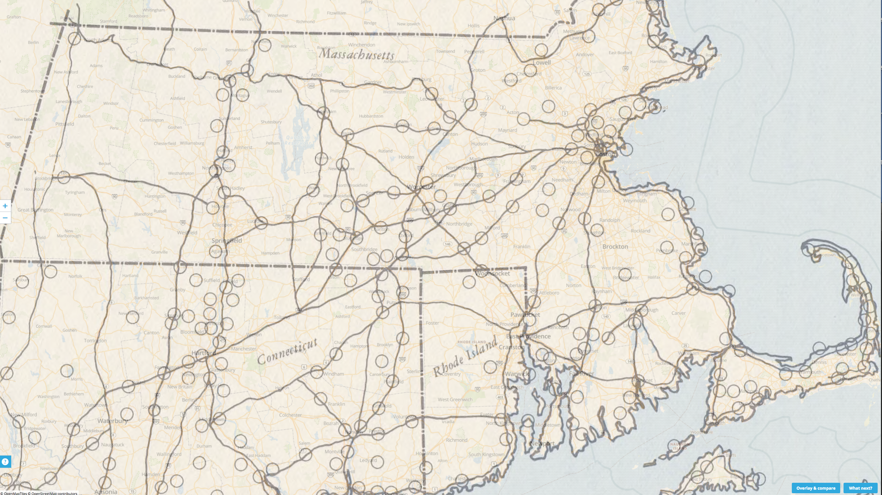
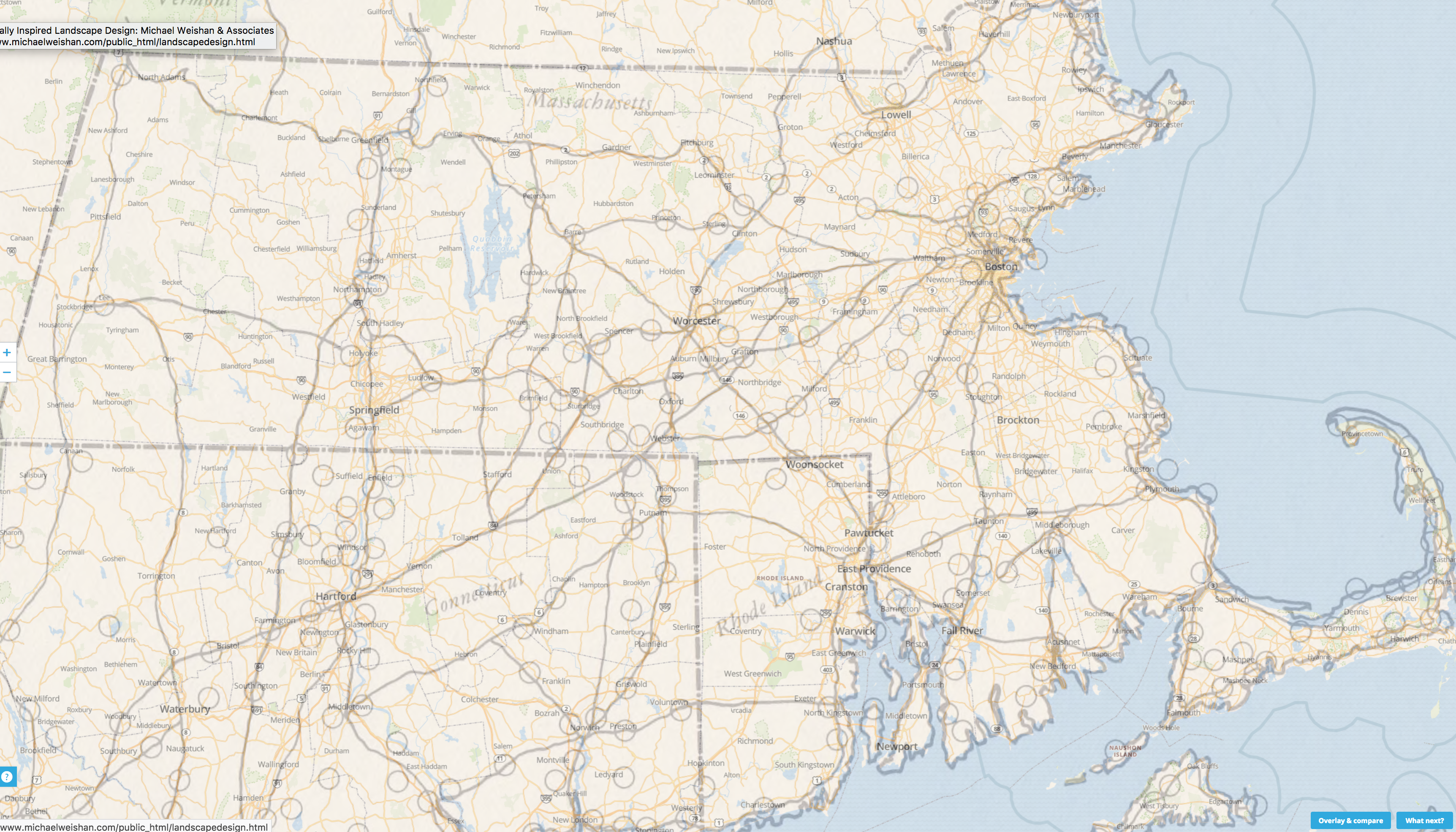
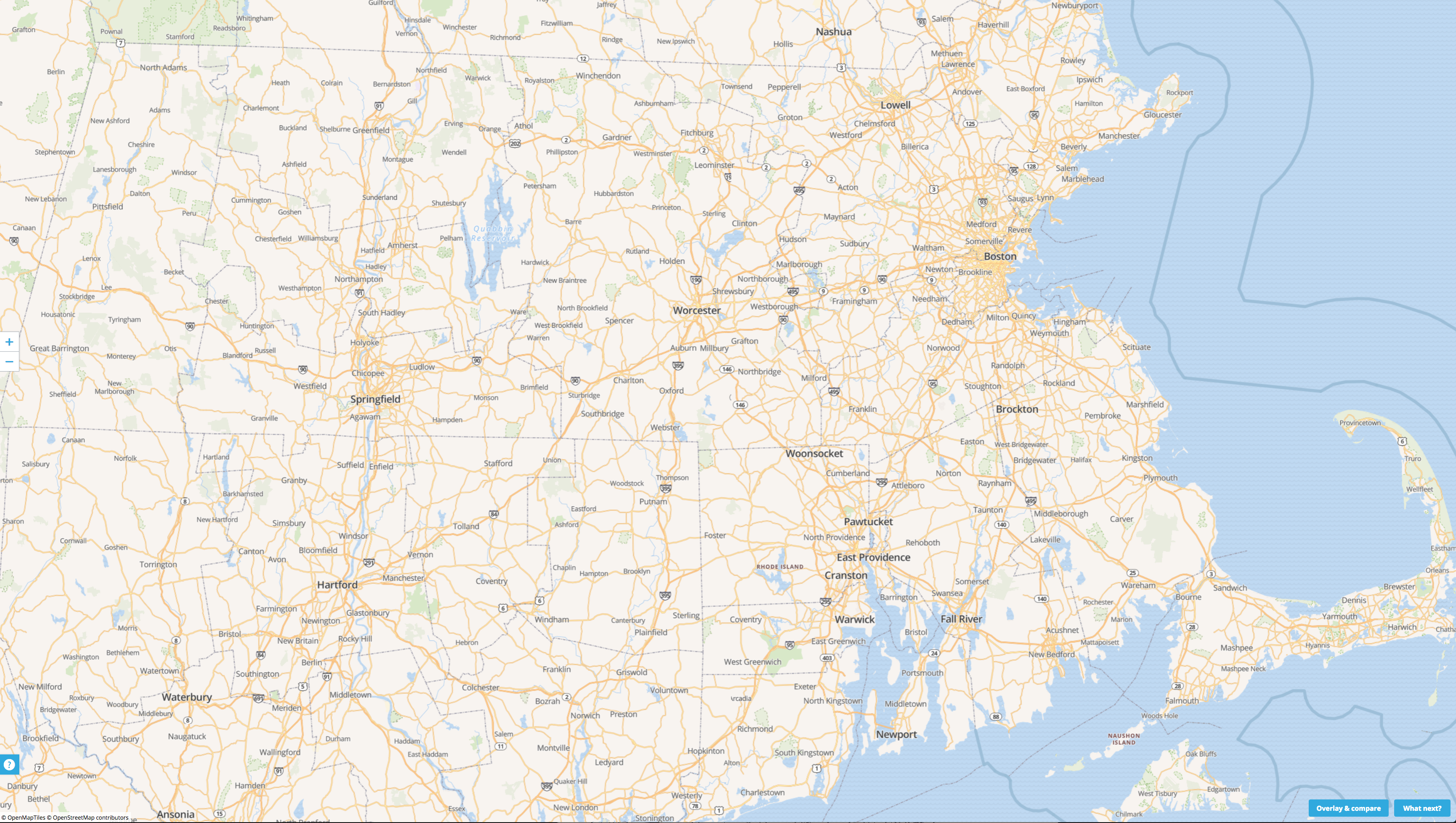
In preparation for expanding the Native American presence at the Museum, I’ve been reading a wonderful book Indian New England before the Mayflower and I came across a very interesting map: “A compilation of certain recorded northern New England Indian trails and villages of the 17th and 18th centuries.” Something about this looked really familiar, so using one of the online map overlay services, I decided to place the Indian trail map over the modern road grid in Massachusetts, Connecticut and Rhode Island.
Wow!
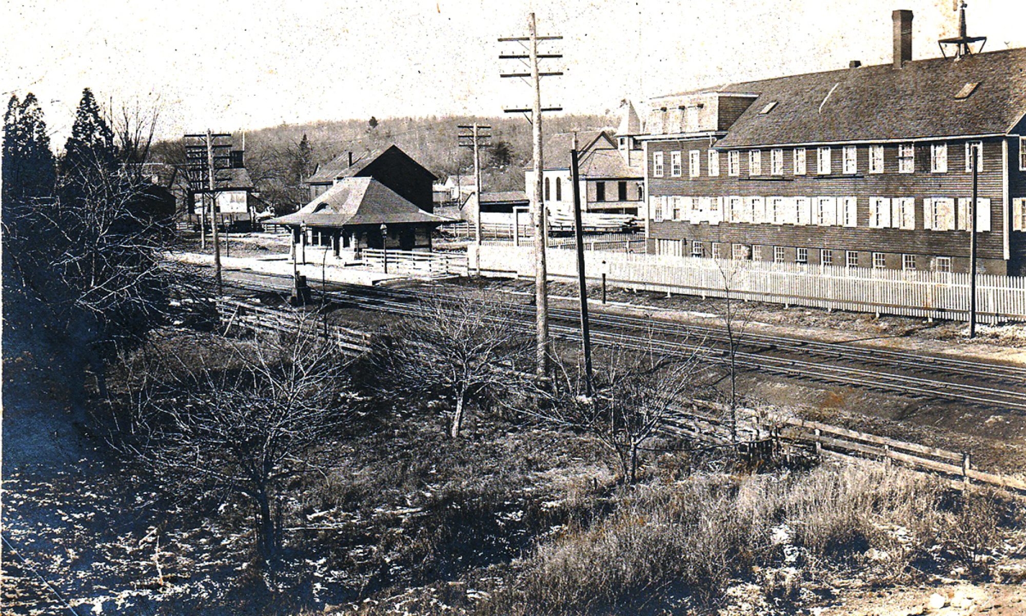
Now I have long known that Main Street and Cordaville Roads in Southborough follow Indian trails, but I didn’t realize so did most of our existing major highways. It’s like the Roman roads in Italy!
Some examples from a cursory review:
Rt 1A its entire length
Rt 2 west of Worcester to the NY border
Rt 3 all the way to the Cape, and from Lowell to Nashua NH
Rt 6A entire length
Rts 7 and 8 (in western Mass) their entire length
Rt 10 from Vermont to Connecticut
Rt. 16 between Webster and Watertown
Rt 20 its entire length
Rt 30 most of its length
Rt 44 entire length
Rt 84 to Hartford and New York
Rt 91 through Springfield
Rt 95 all the way to NYC
Rts 110 and 117 majority of route
Rt 126/135 between Hopkinton and Wayland
I am sure there are others. Take a minute and explore for yourself; just click on any map below to expand. (Or, you can try the slider version of the map, HERE, using the slider in the upper right hand corner labeled “Indian Map” CAREFUL: IT GETS ADDICTIVE)
I suppose in many ways this should have been self-intuitive, as foot paths became cart-paths that became roads that became highways. But somehow, in our European bias, I think many of us (including me) always imagined the first Pilgrims hacking their way through virgin woodland, creating those paths. But the reality is that the Pilgrims and their successors had stepped into a land that had been tended, cultivated and very much altered by Native Americans for thousands of years. The cleared planting fields were already there, as were the fishing camps and weirs, the tended hunting grounds, even the settlement places. But most fatally for the Indian, the well marked land routes were there too, leading the Europeans ever westward with relative ease — to the eventual doom of their civilization.
Something to think about next time you are stuck in traffic…
Interesting to ponder. Thanks Michael. I would think that, in general, native Americans would have chosen “the path of least resistance;” avoiding unnecessary jaunts up hills and through wetlands. It would also be interesting to see an overlay of trails on topographical maps; how they would most likely have skirted those hills and swamps.