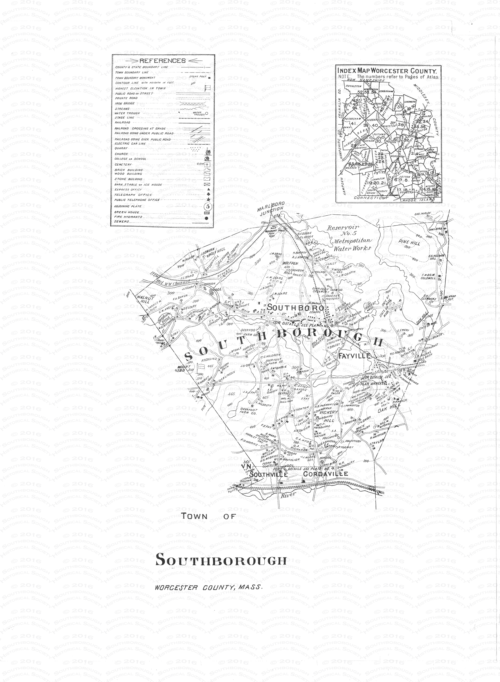
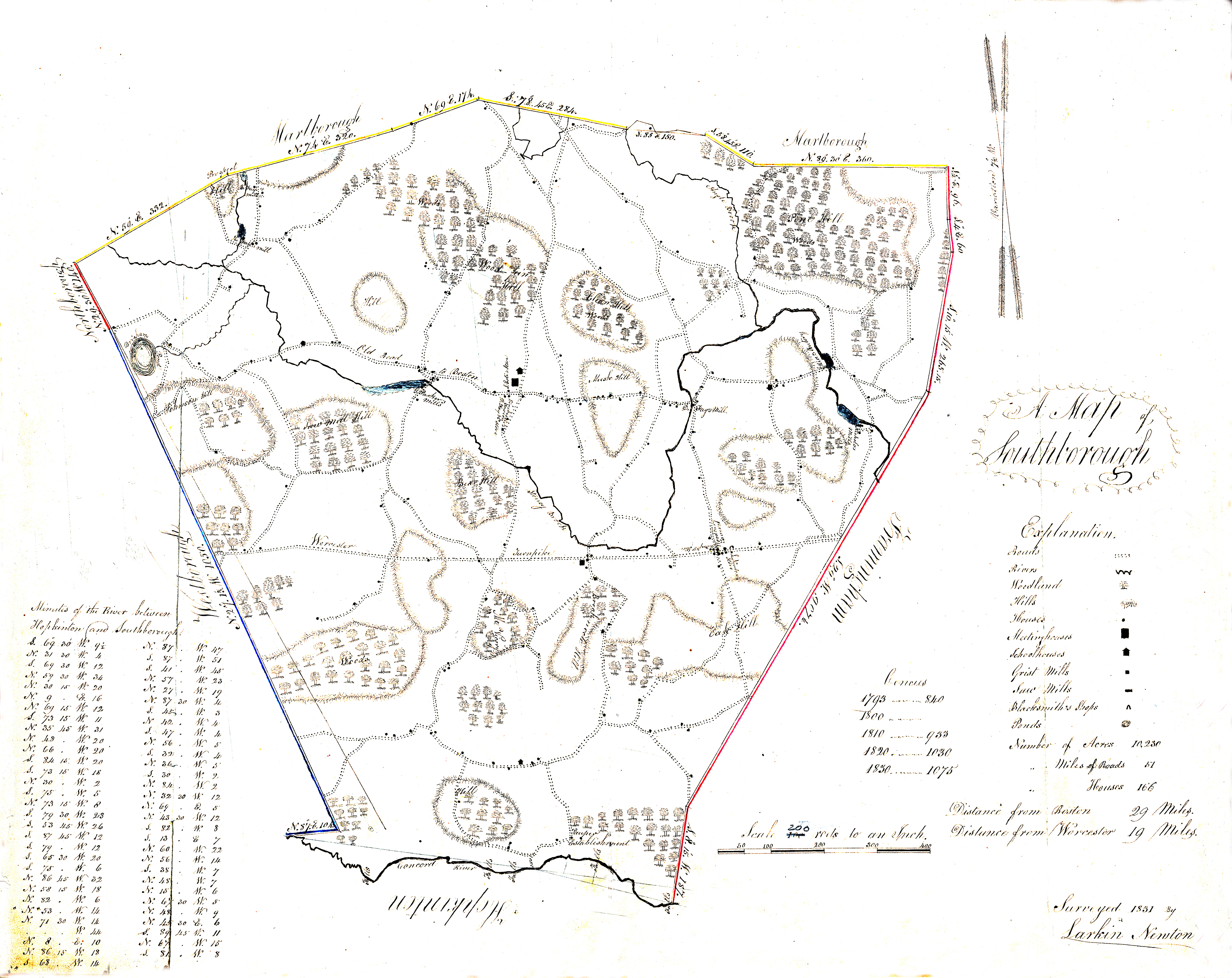
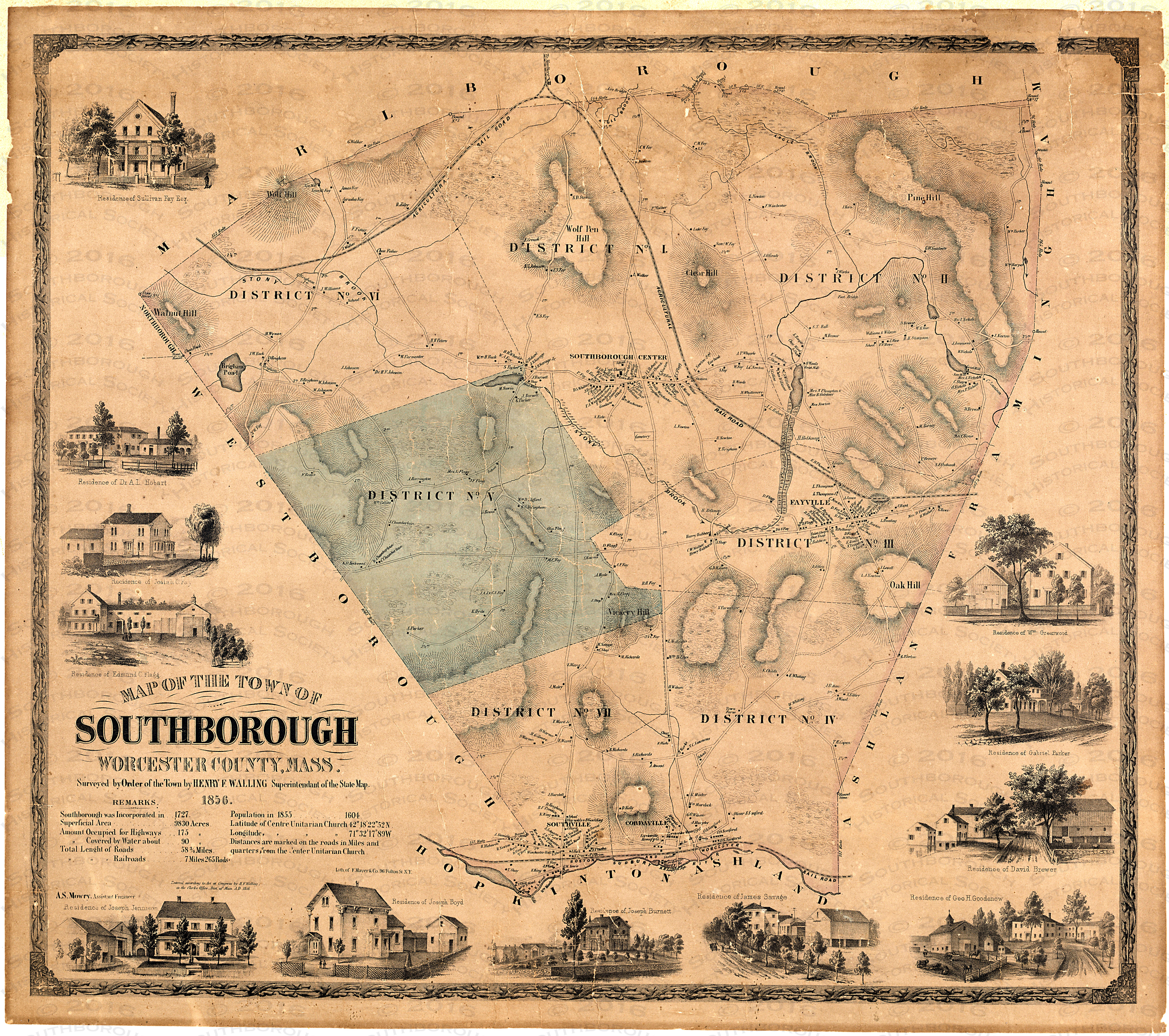
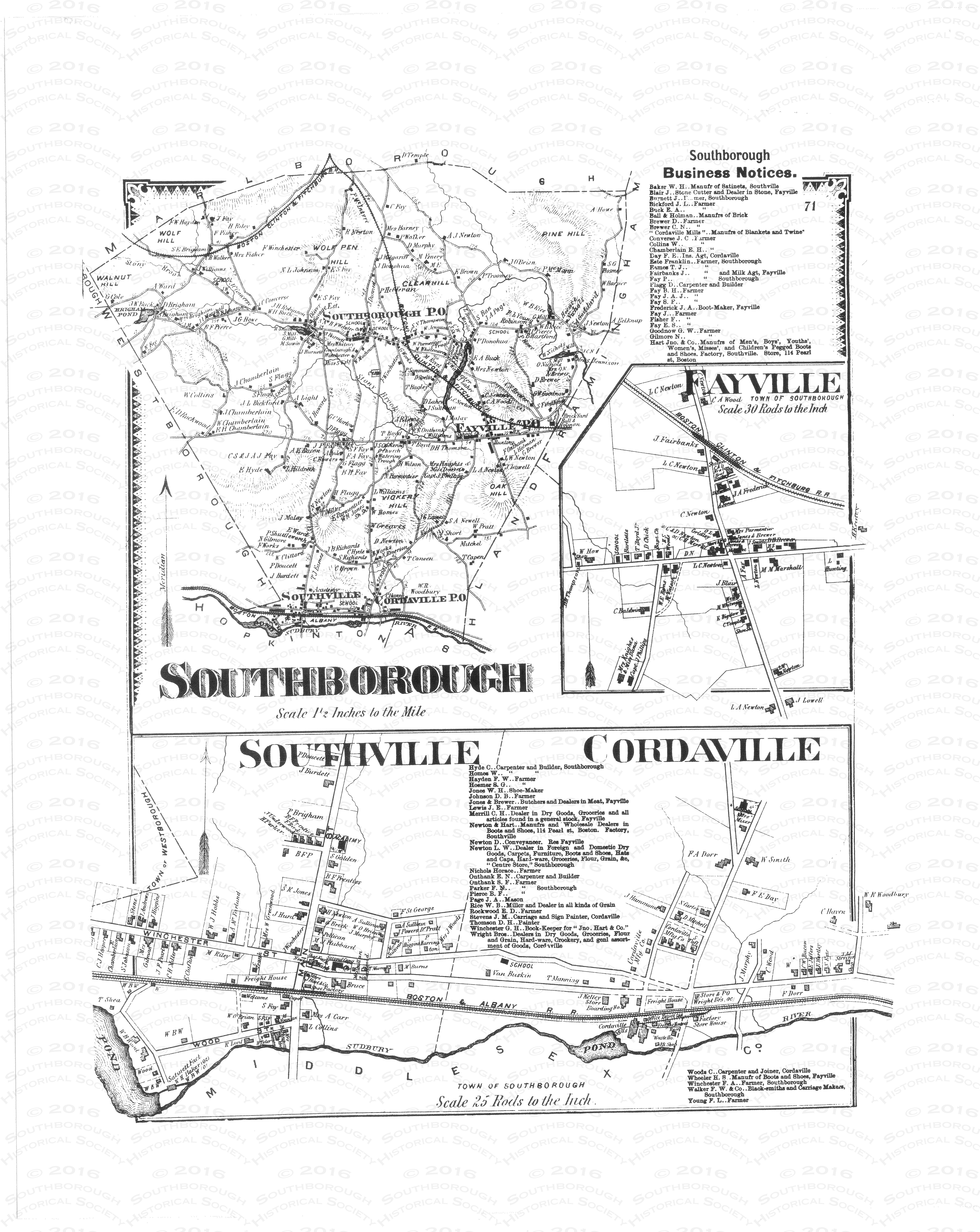
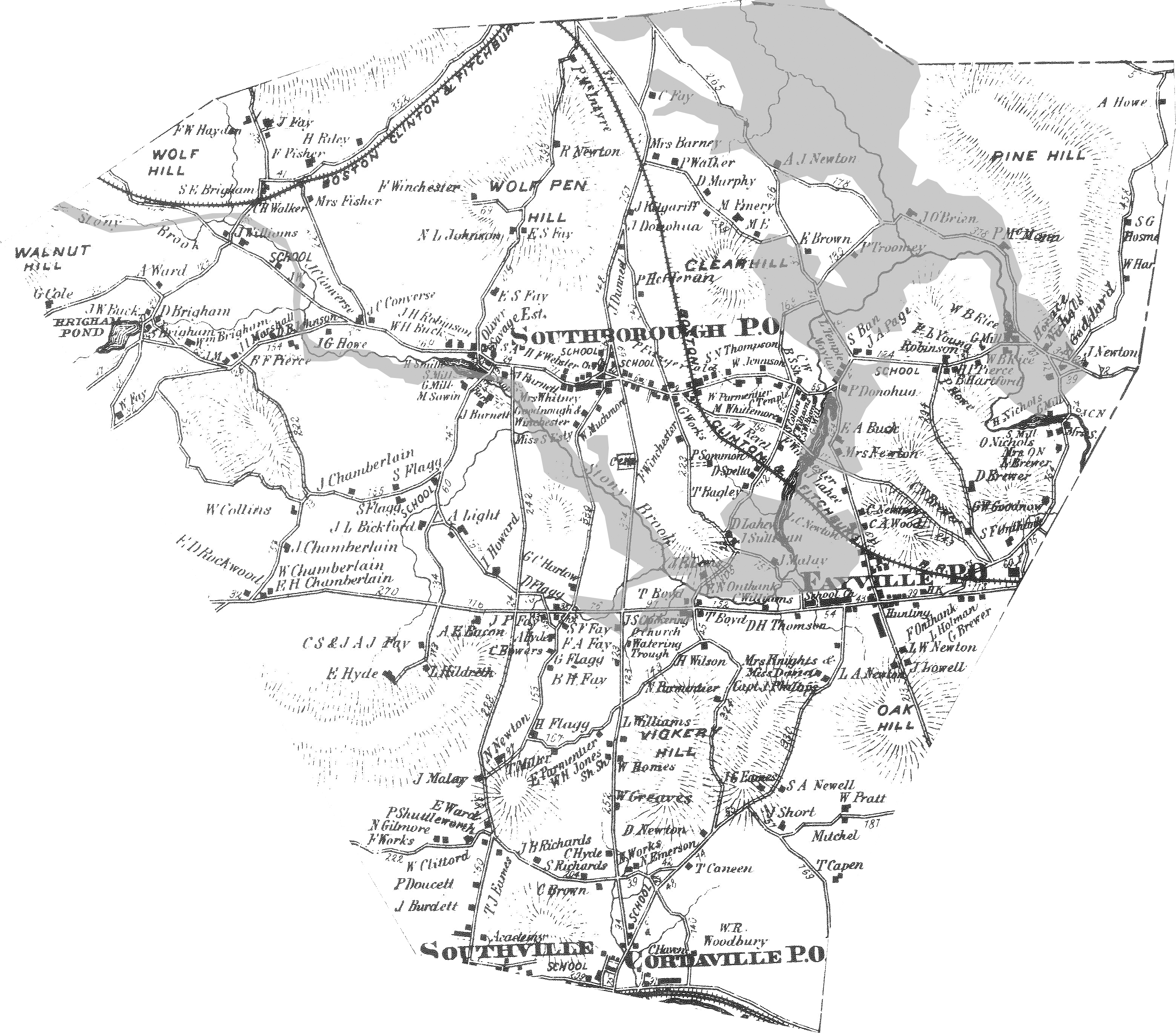
Southborough has been mapped many times, but to history buffs and historic home owners, the maps of 1831, 1854, 1870 and 1898 are of the most interest. They are here presented online for the first time, as large format image files. Click on the map below to explore Southborough in:
1831
1854
1870
1870 (overlaid with areas to be flooded by the new reservoir)
1898